


CHL Maps app for iPhone and iPad
Developer: Michael Rodriguez
First release : 25 Feb 2015
App size: 22.02 Mb
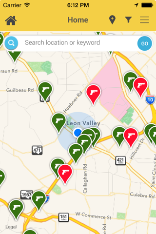
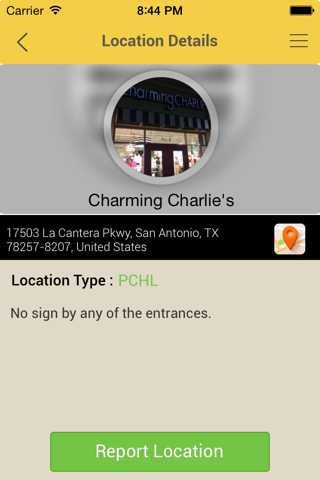
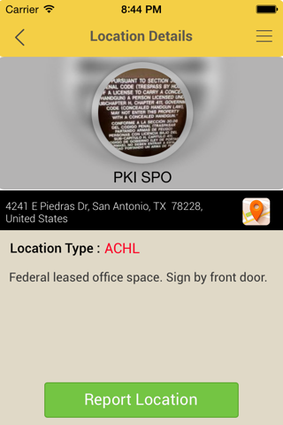
Legally carrying a concealed handgun can be a difficult responsibility. Various federal, state and municipal laws make it challenging for concealed handgun license (CHL) holders to know where they can legally carry. CHL Maps is an informatory app that informs about which locations or businesses are pro-concealed carry (PCHL), and which locations are anti-concealed carry (ACHL). The great thing about CHL Maps is that all of its data is user driven, as in members of the gun community can tag locations throughout their hometowns as they go about their day. The user friendly interface allows for quick submissions, updates and even picture postings of signs or business fronts. CHL Maps integrates GPS functionality to determine tagged locations around you, keyword searches for tagged locations across your city, and even provides direct route navigation. CHL Maps empowers the user to “know before you go”, and to “carry with confidence!” With CHL Maps you can plan your trips to locations that are PCHL and avoid locations that are ACHL. CHL Maps was designed as a tool for law abiding citizens within the gun community to help one another, so get out there and tag as many locations as you can! The more you tag, the better it gets.